One of my Uni projects was to make an app that allowed the user to be able to see their location and the International Space Station (ISS) location plotted on a map, which should regularly update their positions.
The app was to have the following features:
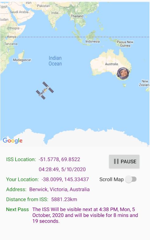
- ISS Latitude and Longitude
- Timestamp that the data was gathered
- User Latitude and Longitude
- The distance between the user and the ISS
- What time the ISS will pass the user and for how long
- User location in a written format
To achieve these critera, I needed to use the Google Maps API, as well as make calls to the Open Notify ISS Current Location and ISS Pass Times APIs. I also needed to use GeoCoder, to be able to convert the Latitude and Longitude to a Street Name and Suburb, and a JSON Reciever to be able to use the API responses.
I implemented an additional scrolling feature, which used the device accelerometer to be able to pan around the map, which could be easilly disabled or enabled via the 'Scoll Map' switch.